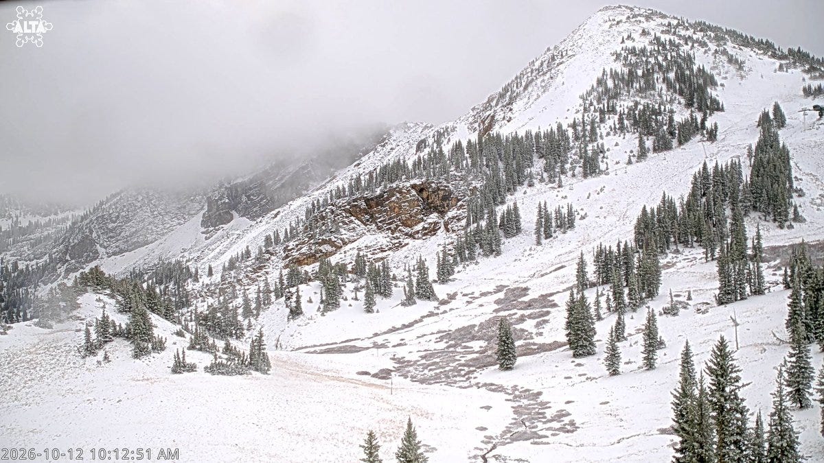
It’s official: the Cottonwoods have their first measurable snow of the season. Alta posted “First measurable snow of the season” at 12:12 PM MDT Monday (post), and by 9:39 PM @WasatchSnow said upper Little Cottonwood had passed 5 in. of total precipitation for the storm (post). For those of us who plan around Utah from somewhere else, that’s the line we’ve been waiting for. It doesn’t spin a lift. It starts the clock.
Then the forecast blinked. The low took a more southern track than expected, toward the Arizona/Nevada/Utah corner and then east across the Desert Southwest, which the NWS forecaster called “not the direct hit from the low that guidance has been predicting in prior days.” Totals “trended downward a bit,” but snow in the Wasatch and Uintas should still be “significant for the early season” (NWS SLC discussion). Because snow was already falling at the top of Little Cottonwood, the Winter Weather Advisory started right away instead of Tuesday morning. It runs until 6 AM MDT Wednesday for the Wasatch south of I-80 and the western Uintas: 3–6 in. in upper Little and Big Cottonwood, more above 9,000 ft, and likely more at Guardsman Pass. Monday’s Flood Watch is gone, and there’s still no Winter Storm Watch or Warning (NWS alerts).
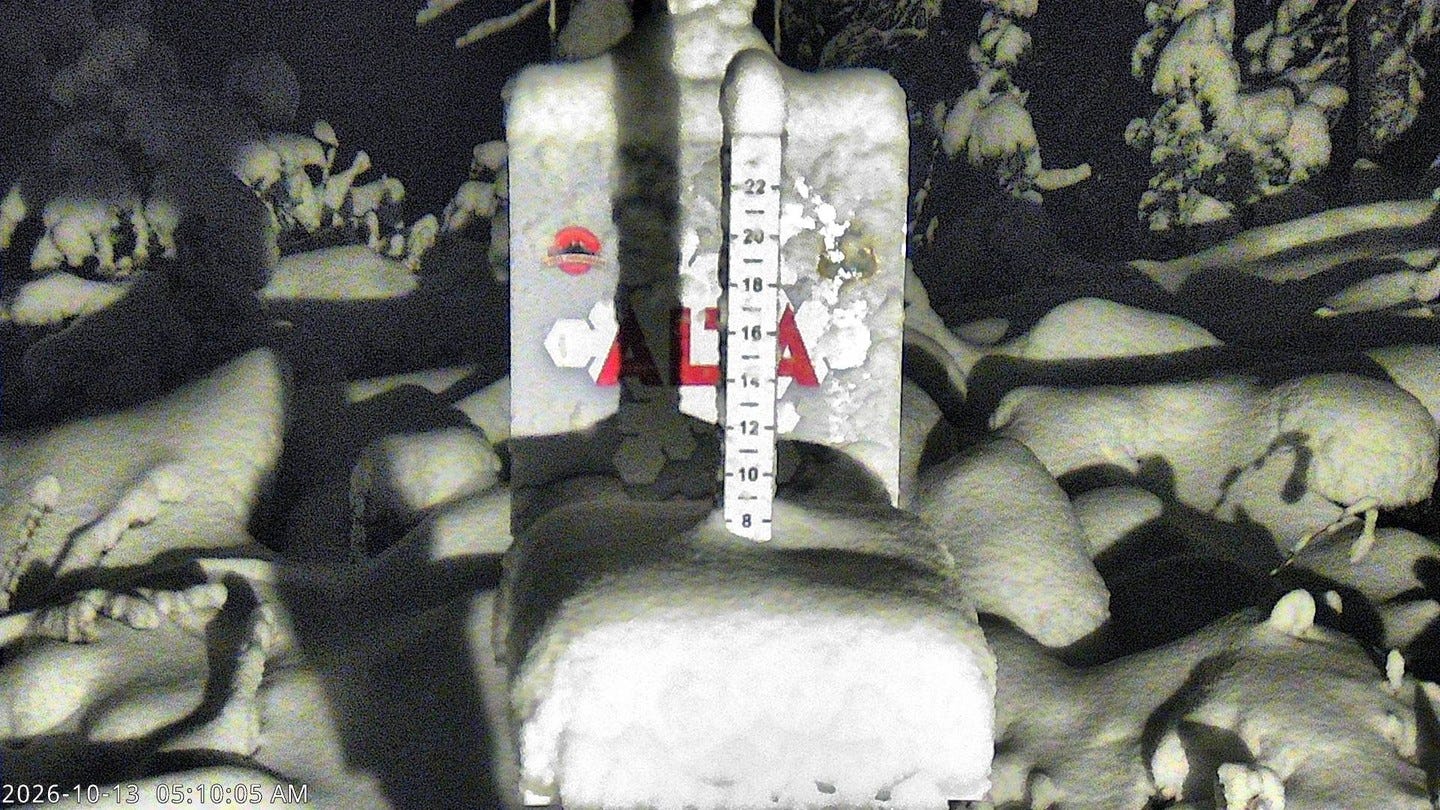
Yesterday’s story was elevation. Today it’s elevation again, only sharper. The 3:00 AM MDT grids tell it top to bottom. Up on Hidden Peak above Snowbird, there’s 3–5 in. overnight, 2–4 Tuesday, 1–3 Tuesday night and under half an inch Wednesday, roughly 6–12 in. still to come, with highs near 29 Tuesday and 31 Wednesday before a sunny 40 on Thursday (NWS Hidden Peak). Alta adds about 3–7 in. and goes sunny and 44 Thursday (NWS Alta). Brighton is down to about 2–3 in., from 5–11 on yesterday’s grid (NWS Brighton). The Snowbird base gets under half an inch overnight and Tuesday, then 1–2 Tuesday night, with a high near 38 Tuesday and 50 Thursday (NWS Snowbird base). The Park City base sees rain and snow showers through Wednesday with little or nothing sticking, then sunny and 57 Thursday (NWS Park City). NWS Salt Lake City says snow levels fall to 7,000–8,000 ft by Tuesday afternoon (post).
The local forecasters are, if anything, more bullish than the grids. @WasatchSnow said at 7:26 AM Monday that more than 4 in. of precipitation had already fallen in parts of the central Wasatch, with snow accumulating above 9,000 ft (post). That post drew about 22K views. At 8:02 PM it bet that Hidden Peak totals “are substantially greater” (post), and at 9:39 PM it said its 6 in. precipitation forecast, which “felt so absurd,” now looks likely to verify (post). OpenSnow Utah’s Evan Thayer called Monday “Time for the Cool Part of the Storm,” with showers through Wednesday and another storm possible next week (OpenSnow Utah). SnowBrains has 10–13 in. more at Alta and Snowbird through Friday, down from its previous update (SnowBrains). Wasatch Weather Weenies’ latest is still Monday morning’s “The Deluge So Far” (WWW).
(When the official grid comes down and the local forecasters hold their number, I don’t pick a side. I read it as the summit and the base about to have very different days.)
On the ground, Unofficial Networks says Alta, Brighton and Solitude all posted snow on social, while Snowbird’s snow stake showed about an inch Monday and the bases were still getting rain (Unofficial Networks). Ten hours later, @WasatchSnow had upper Little Cottonwood past 5 in. of total precipitation. Alta told a follower that some north-facing high terrain will “likely hang on to some of the snow” (post). It dries and warms Thursday through the weekend, and another system could arrive toward the middle of next week (NWS SLC discussion). The Utah Avalanche Center still shows “No rating” for every zone, which means it isn’t forecasting yet (UAC). No rating means no forecast, not no hazard. Early snow on a soaked base deserves respect.
(That north-facing line from Alta is the one I’d underline. Shaded, high, north-facing snow that survives a warm week is what an early base gets built on. A snow total can’t tell you that.)
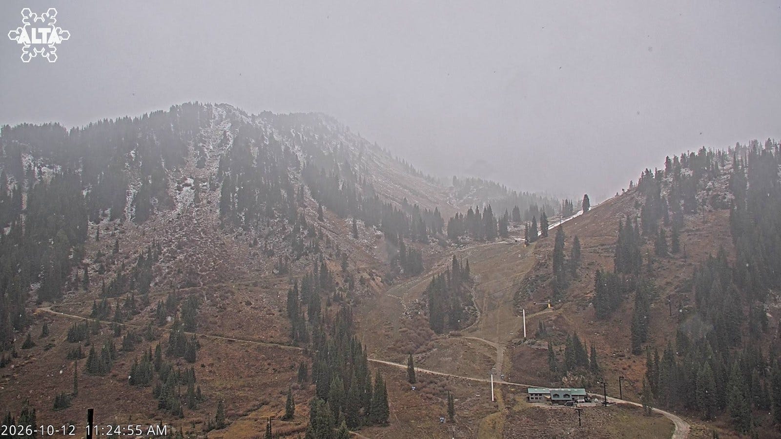
Nothing changes on the calendar. Opening dates hold: Brian Head Nov 6; Alta, Park City and Solitude Nov 20; Snowbasin and Snowbird Nov 27; Deer Valley Dec 5; Powder Mountain Dec 11 (Ski Utah). Still no Utah snowmaking reported. Closer to Springville, brothers Richard and Sam Oldham are building Moose Springs Ranch, a private, off-grid, 400-acre backcountry ski area. It tops out at 8,300 ft with a 1,200-vertical-foot north-facing zone, Richard just published a trail map, and it’s invite-only (Powder).
Colorado is next in line. Chris Tomer’s forecast, via Unofficial Networks, has 1–2 ft possible in the San Juans (Telluride, Silverton, Purgatory, Wolf Creek), about a foot on the 14ers, and 5 in. mid-mountain to 8–10 in. at the summit at Loveland, with snow lingering through Wednesday and maybe Thursday. He’s also eyeing another storm around Oct 21–23 (Unofficial Networks). The NWS grid near Loveland Pass has under half an inch Tuesday and Tuesday night, 2–4 in. Wednesday, then snow “heavy at times” Wednesday night and more Thursday morning (NWS Loveland Pass). Vail stays mostly rain until it flips to snow after midnight Wednesday night (NWS Vail), and a Freeze Watch covers the San Luis Valley through Thursday morning (NWS alerts). A-Basin, Keystone and Loveland are still opening “as soon as possible,” and the Wednesday–Thursday cold is their first real window (OnTheSnow). Farther north, Powder rounded up weekend totals of 12–19 in. at Showdown, plus fresh snow at Big Sky, Bridger Bowl, Lookout Pass, Lost Trail and Blacktail, and at Castle Mountain and Kimberley across the border (Powder). Big Sky and Jackson both turn sunny by Wednesday (NWS Big Sky, NWS Jackson).
Back East, it’s a wet week. Stowe gets heavy rain Tuesday, 1–2 in., plus another half to three-quarters of an inch Tuesday night, with highs of 48–56 and a mostly sunny 51 Thursday. No snow (NWS Stowe), and Vermont has no active alerts (NWS alerts). Lincoln, NH, gets three-quarters of an inch to an inch of rain Tuesday, more Tuesday night, gusts to 40 mph Wednesday night and sun Thursday (NWS Lincoln). Killington’s Oct 6 test is still the latest Vermont snowmaking update. Closer to the Beltway, West Virginia Gov. Patrick Morrisey proposed another $1 million for snowmaking at Canaan Valley Resort State Park, on top of last year’s $6 million. It isn’t approved yet (Unofficial Networks). And if you’re near North Jersey today, Big SNOW is offering 50% off Snow Day Packages or 2-hour passes to guests wearing pink (SnowBrains).
(For DC skiers, Canaan is a drive, not a flight. Snowmaking money there is the kind of news that decides whether a December weekend in West Virginia is worth it.)
Worth a click
The big-picture read of the week is SKI’s “Where Experts Say Early-Season Skiing Could Be Best During the 2026–’27 El Niño,” which cites the Climate Prediction Center’s 75% chance of a historic event stronger than any since 1950 (SKI). Chris Benchetler’s Grateful Dead homage Mountains of the Moon is now online, per Powder (post), and Powder’s review describes glowing riders in a pillow field (Powder). Blister Podcast Ep. 427 (Oct 12) has Hoji, Chris Rubens and McKenna Peterson on crashes and close calls (Blister), and Season 7 of the SnowBrains Podcast launches today (SnowBrains).
On the gear side, Powder’s new 2027 reviews include the Stöckli Stormrider 95, two sheets of Titanal built to be “pointed down a corduroy-laden groomer,” the Elan Ripstick 96 Black Edition (133–96–114 mm, extra carbon), the Nordica Enforcer 99, and a Best Women’s Skis of 2027 roundup. SKI’s deal of the week is the Flylow Wolverine lobster glove (SKI). In the delightfully odd category, Austrian inventor Paul Demschar wants to retrofit compatible gondola cabins into hot tubs (SnowBrains).
In racing, Sölden snow control is Thursday, Oct 15, with the women’s and men’s GS on Oct 24 and 25 (SnowBrains). Sweden’s 2022 Olympic moguls champion Walter Wallberg will sit out the season to recover from injuries (SnowBrains). Two-time Olympic snowboard champion Anna Gasser will retire after this season, with farewell stops at Innsbruck’s Airdrenaline big air (Nov 27–28), Kreischberg (Jan 8–9) and the World Championships in Montafon in March (SnowBrains). X Games posted its league’s XC Whistler team (post), and wind called off the men’s Red Bull Rampage final on Oct 10 with no winner; Szymon Godziek led with a 90 when it stopped (Unofficial Networks).
Around the resort world: Kimberley, BC, has the bottom terminal of its new Leitner-Poma Tamarack quad in, with towers going in by helicopter and a December 2026 target (SnowBrains). Sasquatch, BC, whose Green Chair never ran last season, posted new dates, hours and passes but stayed vague on whether every lift will run (Unofficial Networks). PeakRankings scored Loon 51, fifth in New Hampshire and 26th in the East, citing weekend crowds and no trail link between North and South Peak (Unofficial Networks). Valle Nevado in Chile pushed its closing to Nov 8 after a big storm (TGR), and Titlis-Engelberg pushed its glacier opening from Oct 10 to Oct 24 (SnowBrains).
Check your beacon, point ‘em downhill, and drop in.
I write this for people who plan around the mountains instead of living in them. If that’s you, subscribe free.
The Beacon and Probe lands in your inbox before first chair. Free, honest, no hype.
Photos: Alta Ski Area webcams.
