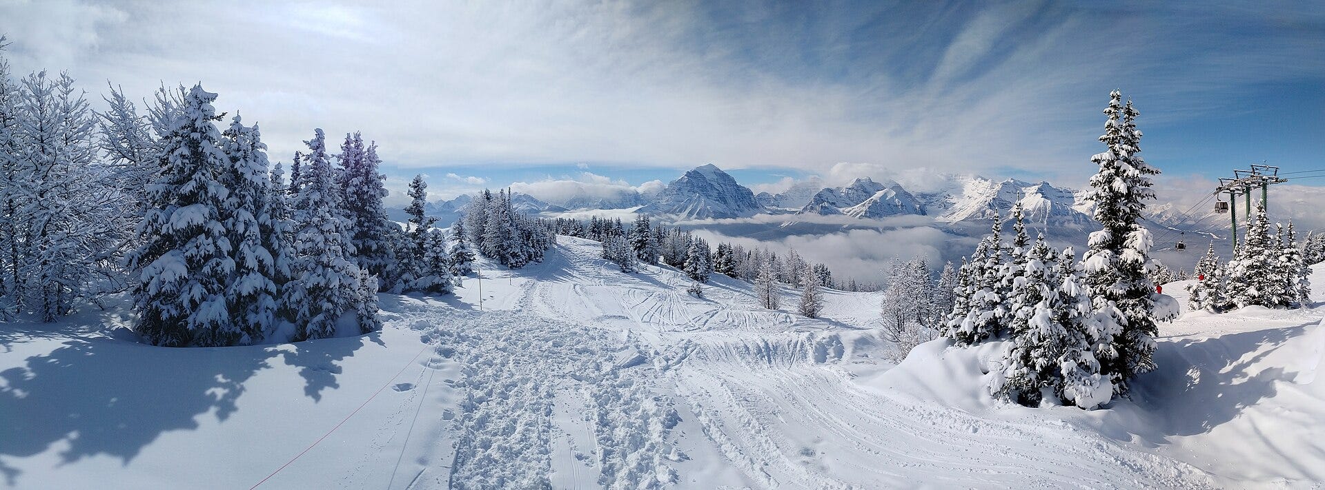
November is my favorite month of the year. Ski season is almost here, and this is when it starts to feel real.
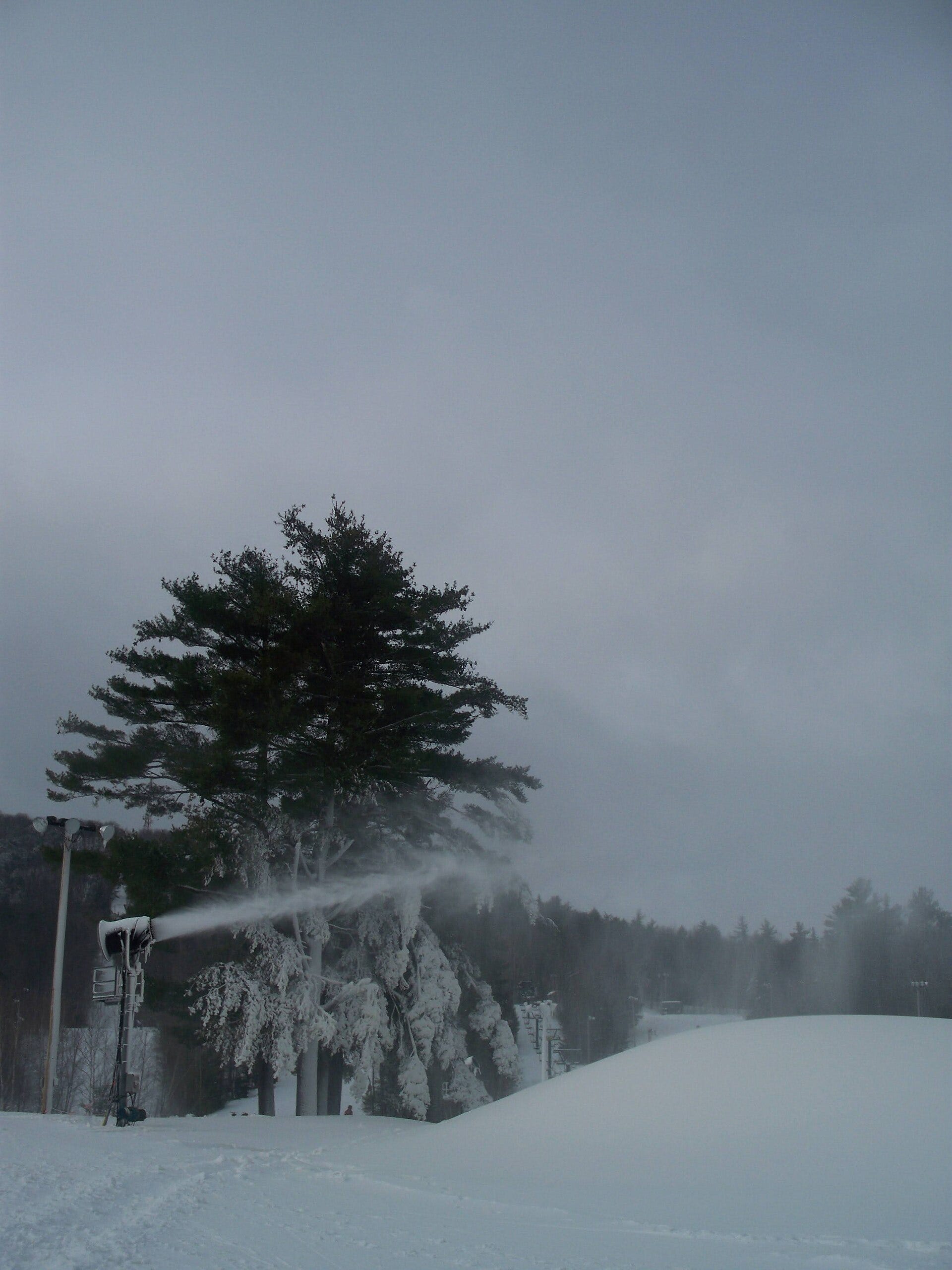
You can watch it happen from your couch. A-Basin is spinning, and Lake Louise opens today. In the East, snowmaking crews are laying down whale after whale on the cold nights, and Killington had about 135 snowguns going on Saturday. Webcams that showed dirt and brown grass two weeks ago now show white. I check them more than I’d like to admit.
Then it picks up. Colorado resorts start posting videos, and storms start lining up, like the one hitting the Cottonwoods right now. Skis come down from the rafters, the boots come out of the closet, and somebody in your group chat is already talking about heading up. Around Thanksgiving more resorts come online, and the farther-out places start issuing real snow reports instead of hopeful ones.
If the stoke isn’t on already, time for you to log in before you click in. There’s plenty to watch.
Story of the Day
The storm is here, and it’s smaller than Friday’s forecast but still a real one for the upper Cottonwoods. Alta reported 2 in. overnight and a 4-in. base on the official Utah snow report at 3:07 AM MT (Ski Utah). The National Weather Service now has a Winter Weather Advisory for the Wasatch south of I-80 and the western Uintas until 11 AM Monday. It calls for 8 to 12 in. above 8,000 ft, “with locally 18 to 24 inches in the upper Cottonwoods above 9000 feet,” and gusts to 45 mph (NWS alerts).
The numbers came down from Friday night. NWS’s point forecast for Alta now adds up to roughly 10 to 22 in. through Monday (1–3 overnight, 3–7 Sunday, 5–9 Sunday night, 1–3 Monday). Yesterday’s version added up to 21–32 (NWS Alta). The Salt Lake office’s Saturday night discussion explains why the top still wins. The atmospheric river feeds southern Utah first, then snow levels fall “below 8000 feet by late Sunday evening,” and post-frontal northwest flow keeps the I-15 corridor going through Sunday night. That means 3–6 in. below 9,000 ft and “perhaps upwards of 20” in the upper Cottonwoods (NWS SLC discussion).
The lower numbers don’t bother me much. The early forecasts of two-plus feet everywhere were never likely to hold. It’s wet snow up high today, colder snow tonight, then a dry Tuesday for it to settle. That’s base-building snow, and a base is what Alta and Solitude need for Nov 20 (Ski Utah).
NWS also says “traction law restrictions may be enacted” (NWS alerts). The resorts aren’t even open yet. Hopefully in the not-too-distant future, gondolas will eliminate this issue.
Photo of the Day
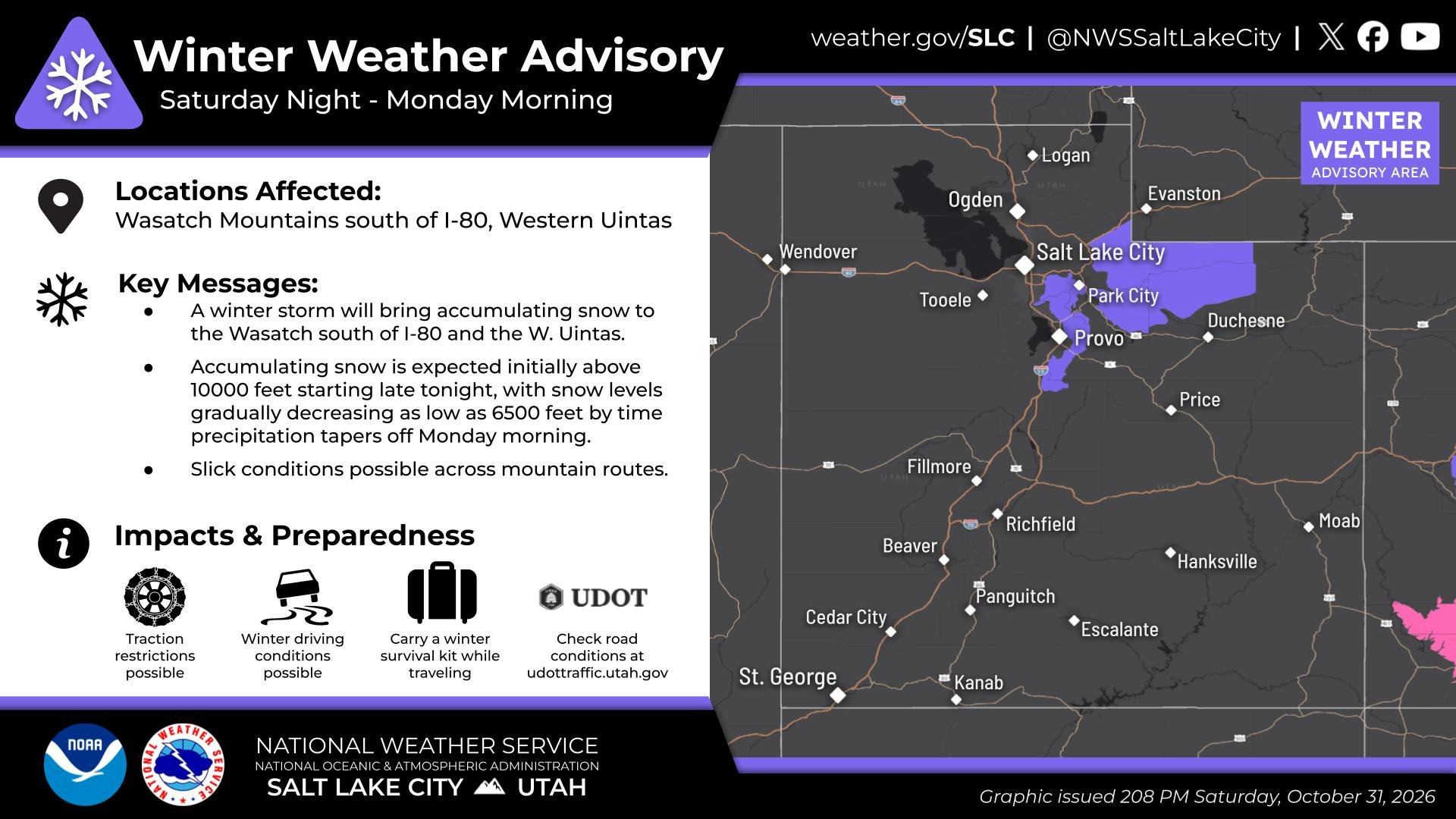
“A Winter Weather Advisory is in effect starting tonight through Monday AM, as a cold front brings decreasing snow levels resulting in accumulating mtn snow, mainly above 8000 feet,” posted by NWS Salt Lake City (@NWSSaltLakeCity) on Sat Oct 31 at 2:17 PM MDT (post). I viewed the graphic. It’s the official advisory card: the Wasatch south of I-80 and the western Uintas shaded purple on a Utah map, with key messages that snow starts above 10,000 ft and that snow levels drop “as low as 6500 feet by time precipitation tapers off Monday morning.” The card says “Graphic issued 208 PM Saturday, October 31, 2026.” About 5.3K views and 33 likes at research time.
Photo: NWS Salt Lake City (@NWSSaltLakeCity) on X.
News of the Day
Storm Watch
Cottonwoods / Utah
Winter Weather Advisory (new): It runs until 11 AM MST Monday for the Wasatch south of I-80 and the western Uintas. It calls for 8–12 in. above 8,000 ft, locally 18–24 in. in the upper Cottonwoods above 9,000 ft, and gusts to 45 mph. Travel could be difficult, and traction restrictions are possible (NWS alerts).
Alta snow report: 2 in. overnight and in the last 24 hours, with a 4-in. base, as of 3:07 AM MT (Ski Utah).
NWS point forecast for Alta (updated 12:31 AM MDT Sun): Overnight 1–3 in., Sunday 3–7 in., Sunday night 5–9 in., Monday 1–3 in. That’s about 10–22 in. in total, down from 21–32 in yesterday’s report. Tuesday is mostly sunny with a high near 41 (NWS Alta).
NWS grid (updated 12:31 AM MDT Sun): Alta’s cell is about 9.9 in. for Sun–Mon, Hidden Peak’s about 17.7 in. and Brighton’s about 4.4 in. Yesterday the numbers were 16.7, 22.7 and 10.0. Each cell adds about 1–2 in. Wed Nov 4 (Alta grid, Hidden Peak grid, Brighton grid).
NWS discussion (9:06 PM MDT Sat): Upwards of 12 in. above 9,000 ft and 3–6 in. down to about 7,000 ft, with locally 18–24 in. in the upper Cottonwoods and western Uintas. A flood watch covers southern and east-central Utah. Tuesday is dry, and a weaker system comes Wednesday into Thursday “lack[ing] the moisture tap of recent events.” Models lean toward a ridge next weekend (NWS SLC discussion).
Conflict flag: The point forecast (10–22 in.) still runs ahead of the Alta grid cell (about 10 in.). The advisory’s 18–24 in. applies only to the upper Cottonwoods above 9,000 ft, which lines up better with the Hidden Peak cell (about 18 in.).
Wasatch Weather Weenies: No new post since Friday’s RRFS update. The new models are still set to go operational Nov 3 (WWW).
Colorado / West
San Juans (upgraded): NWS Grand Junction upgraded the Northwest and Southwest San Juans to a Winter Storm Warning until noon Monday. NWS Pueblo did the same for the Eastern San Juans above 10,000 ft until 11 AM Monday. A Winter Weather Advisory still covers the Gores, Elks, West Elks, Sawatch, Flat Tops and Grand Mesa until 6 PM Monday. Flood watches and warnings cover the Four Corners and San Luis Valley, and there’s an Avalanche Advisory for the San Juans, West Elks and Sawatch (NWS alerts).
OpenSnow via Sunset: OpenSnow expects 6–12 in. for nearly all Colorado mountains Sunday through Tuesday, with 12–20 in. in some spots (Sunset).
Northern Greens / East
Stowe: Mostly clear and 27 overnight, then sunny and 57 Sunday, 42 Sunday night and 62 Monday (NWS Stowe). There are no Vermont alerts (NWS alerts).
Openings & Snowmaking
Lake Louise opens today (new): First chair is at 9:30 AM on Juniper Express and Easy Street, with two small early-season parks. It’s the resort’s second-earliest opening on record and its earliest in five years (Lake Louise). Its earliest ever was Oct 29, 2020 (Unofficial Networks).
Banff (new): Norquay moved its opening up from Nov 7 to Fri Nov 6, the same day Sunshine Village plans to open (Unofficial Networks, Snow-Forecast). Planet Ski still lists Norquay for Nov 7, but Norquay’s own quoted post says Nov 6.
Killington (updated): As of Saturday’s 11:44 AM report, about 135 snowguns were running on Great Northern, Rime and Reason, and crews hoped to move to Superstar overnight if it stayed cold. There’s still no opening date (Killington mountain report).
Brian Head (unchanged): It’s still on for Fri Nov 6, with lifts at 9:30 AM (Brian Head).
Colorado: Breckenridge and Copper are targeting Nov 6, and Vail Nov 13 (Sunset). Loveland still hasn’t announced a date. It’s aiming for “late October or early November” (Loveland).
Resort News
Killington (new): In its third year of independent ownership, Killington is spending another $15 million on capital improvements, for $80 million since fall 2024. It projects $200 million more over the next decade (Killington mountain report).
A-Basin: It plans to run seven days a week for the rest of the season. Ikon and Ikon Base holders get unlimited access (CBS Colorado).
Racing & Events
Killington Cup: Women’s World Cup racing on Superstar, Nov 27–29. The live music lineup is out (Killington mountain report).
Natural Selection Tour (carried): 2027 dates and location are expected in mid-November (Powder).
Gear
The North Face x U.S. Ski Team (carried): The capsule goes on sale to the public Tue Nov 3 (Powder).
Powder (new): A post on Bonvo, pitched as a way to “tour around your favorite haunts” from Palisades Tahoe to Killington (@PowderMagazine).
Socials & Trends
Most-viewed in the watchlist window: Mikaela Shiffrin’s video post (just an eyes emoji, no words) had about 13K views and 680 likes. (@MikaelaShiffrin). NWS Salt Lake City’s advisory post had about 5.3K (@NWSSaltLakeCity).
NWS Salt Lake City: It warned that “even light snowfall accum can result in difficult travel” on mountain routes (@NWSSaltLakeCity).
Powder: It covered Lake Louise’s “second earliest” opening (@PowderMagazine).
Quiet in the searched window: @AltaSkiArea, @Snowbird, @OpenSnow, @ProfessorPowder, @utavy_, @IkonPass, @fisalpine, @FreerideWTour, @XGames, @Newschoolers, @ChrisBenchetler, @lindseyvonn and @usskiteam. @WasatchSnow had only a reply.
Google Trends: I didn’t check this morning. IG and TikTok aren’t connected.
Media & Podcasts
Powder (new): “After a hiatus, Tudor is releasing a new movie that documents the next chapter of his career” (@PowderMagazine).
Sunset (new): “With Snow Guns Running and a Big El Niño Brewing, Western Ski Season Is Taking Shape.” It notes that Brian Head’s opener slipped to Nov 21 last year (Sunset).
Closing detail
When I checked overnight, about 3:15 AM MT Sunday, Killington Peak (4,241 ft) read 26°F while the K-1 Lodge (2,500 ft) read 32°F (Killington mountain report).
Gear Check: Last Year’s Colors, This Year’s Skis
A lot of this season’s skis are last season’s skis with new graphics on top. If the core and shape didn’t change, the ski didn’t either. Last year’s stock usually goes on sale around now, and it doesn’t stick around long.
Where to look:
Sizes go first, especially the popular lengths. If you’ve been staring at a pair since spring, now is a good time to look. Nobody on the chairlift has ever asked me what color my skis were.
Here’s the nudge, and this time I mean it. Passes have already gone up, and they’ll go up again. Hotels and flights are climbing too. Mountain Collective, for one, says its prices go up after Nov 17 (Mountain Collective). The sooner you book, the further your money goes. Get on it.
Ski the East: Snowbound Expo, Nov 14-15
If you ski the East, put this on the calendar. Snowbound Expo runs Saturday and Sunday, Nov 14-15, at Mohegan Sun in Uncasville, Conn. (Snowbound Expo). That’s two weekends from now. It’s the Northeast’s big season kickoff show, with resorts, shops and gear in one place.
It’s a good place to figure out where your season starts. Talk to the resorts, compare passes, and go home with a plan.
I’ll be there. I’m a Snowbound ambassador, I don’t make any money from it, and I do it for the love of the game. Let me know if I’ll see you there. I’ll probably be talking about snowmaking reports.
Before You Go
It’s snowing up high in the Cottonwoods, Lake Louise is open, and the East is making snow on the cold nights. Go wax your skis and find your gloves. I’ll be checking the cams again tonight. See you on the hill soon.
The Beacon and Probe lands in your inbox before first chair. Free.
Check your beacon, point ’em downhill, and drop in.
Final Reads
What skiers are reading this week
Chile’s Valle Nevado Extends Its Season Into December (Unofficial Networks): 24 feet of snow, 154 operating days, and lifts spinning until Dec 1. They’re still skiing in Chile.
Safety of Breckenridge’s Town Gondola Challenged by Local Resident (Unofficial Networks): The state tramway board takes it up Nov 4, two days before Breck plans to open.
Villa at the von Trapp Family Lodge Damaged by Fire (Unofficial Networks): One villa lost, no one hurt, and the rest of a Stowe landmark made it through fine.
Why Québec Is the Ultimate East Coast Ski Destination (Outside): Worth reading if you’re thinking about a trip north this winter.
On the edge
NOAA’s new storm-scale model goes live Tuesday. After years of delays, the Rapid Refresh Forecast System (RRFS) and its ensemble (REFS) are still on track to go operational Nov 3. They run at 3-km grid spacing and should eventually replace the HRRR. University of Utah meteorologist Jim Steenburgh notes that the model smooths out Wasatch terrain more than the HRRR does, and that “we will all be learning as we go this winter.” Source: Wasatch Weather Weenies.
Poll
From the archive
If you missed it, this is still the one I’d send a friend: Erik Mogensen Is the Most Important Story in Skiing.
